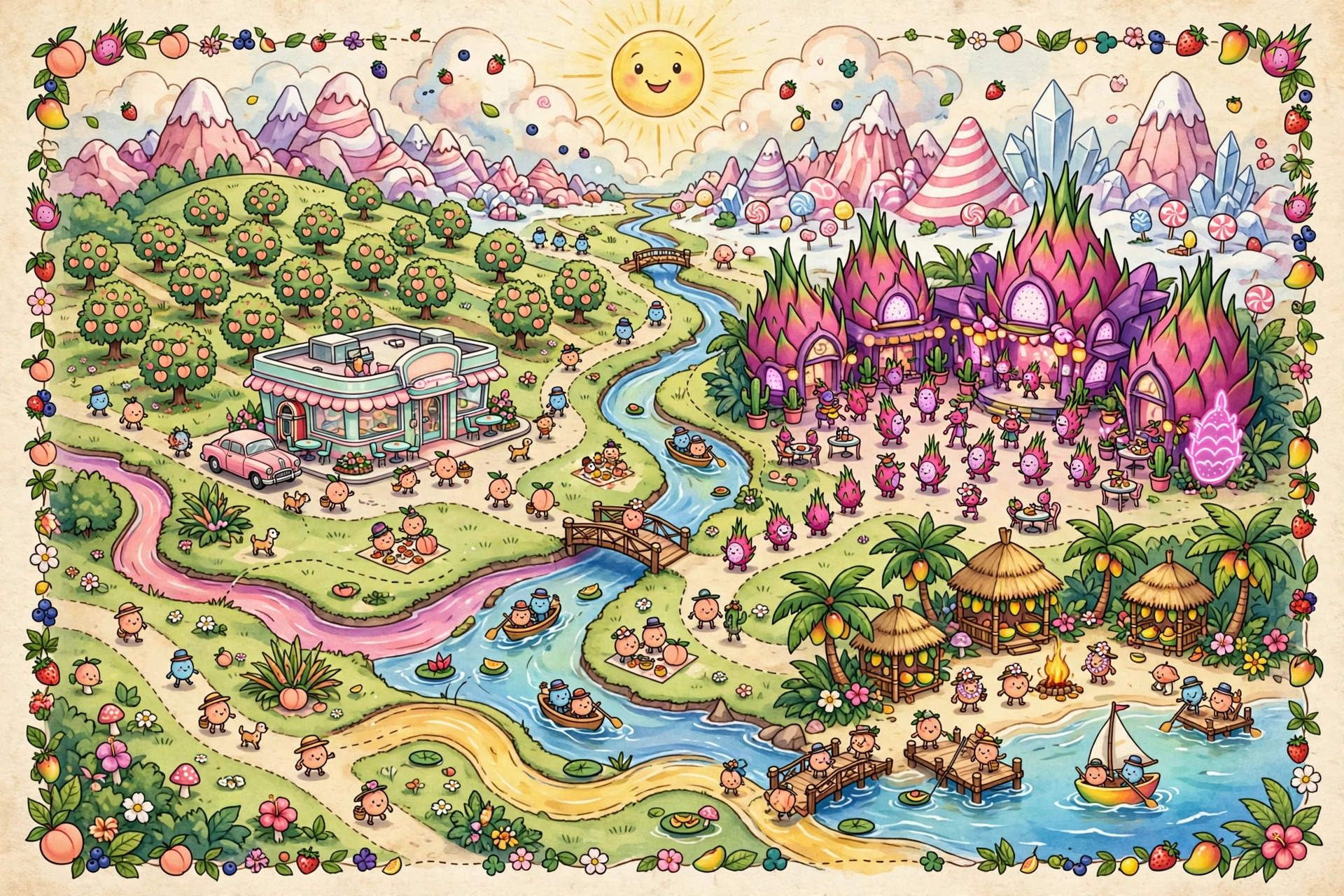
How the land lies
Fruitopia sits in a wide, sun-tilted basin. The Candy Peaks wall off the north; the Juice Rivers braid down from their sugar-springs through Orchard Valley; the Neon Grove rises where the rivers meet the lagoon; and Tiki Cove opens to the southern sea. The whole basin is about a three-day skate — or one long sail — across.
| Region | Character | Notes |
|---|---|---|
| Orchard Valley | Rolling orchards, blossom groves | Peach, apple, cherry and berry groves; the Peach Pit Diner at its heart |
| Neon Grove | Nightclub district on the lagoon | Art-deco towers, velvet-roped clubs, open all night |
| Tiki Cove | Beach crescent and palm groves | The Sunset Still, mango groves, sunset point |
| Candy Peaks | Northern mountains | Sugar mines, sled runs, the annual Summit Sled Race |
| Juice Rivers | Braided waterways | Peel-boat traffic, fishing, message-bottle post |
| The Mellow Marsh | Eastern wetlands | Melon farms, firefly tours, famously slow living |
Getting around
- Peel-boats on the Juice Rivers — the commuter fleet of Fruitopia.
- Roller skates in the valley towns — see: Georgia Melba, expert.
- Sail and outrigger around the cove and lagoon.
- The Night Tram — the Grove's neon-lit streetcar, running till dawn.
Georgia's corner
The Peach Pit Diner anchors Orchard Valley — and Georgia Melba is the reason half the valley's stories start with “so I was at the Pit when...”